Geolocate

Daylesford topographic map

Click on the map to display elevation.

About this map

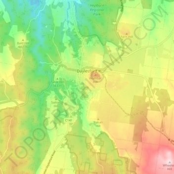
Name: Daylesford topographic map, elevation, terrain.

Location: Daylesford, Shire of Hepburn, Victoria, 3460, Australia (-37.38550 144.09549 -37.31171 144.19184)

Average elevation: 587 m

Minimum elevation: 423 m

Maximum elevation: 794 m

Gear up for your next adventure:

🍽️Titanium Camping Spork - Ultralight and indestructible eating utensil
🦯Trekking Poles - Reduced impact on joints for steep topographic climbs
🌡️Emergency Mylar Blankets - Compact thermal protection for unexpected nights outdoors
💧Hydration Bladder - Hands-free hydration solution for long treks
🔨Vehicle Emergency Tool - Safety tool for remote road trips to trailheads

As an Amazon Associate, this site earns from qualifying purchases at no extra cost to you.