Geolocate

Muñapucro topographic map

Click on the map to display elevation.

About this map

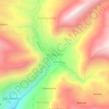
Name: Muñapucro topographic map, elevation, terrain.

Location: Muñapucro, Anco-Huallo, Chincheros, Apurímac, Perú (-13.63577 -73.70502 -13.59577 -73.66502)

Average elevation: 3,490 m

Minimum elevation: 2,867 m

Maximum elevation: 3,960 m

Gear up for your next adventure:

🥾Hiking Shorts - Breathable shorts suitable for summer hikes
🚲MTB Frame Bag - Carry tools and maps directly on your bicycle frame
🥾Mountain Trail Shoes - High-traction shoes for mountain trails
🕶️Polarized Sunglasses - Reduces glare from snow and water at high elevations
🕯️Camping Lantern - Illuminates your entire campsite with high-efficiency LEDs

As an Amazon Associate, this site earns from qualifying purchases at no extra cost to you.