
Mae Sai Subdistrict topographic map
Interactive map
Click on the map to display elevation.
About this map
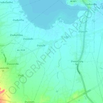
Name: Mae Sai Subdistrict topographic map, elevation, terrain.
Average elevation: 401 m
Minimum elevation: 390 m
Maximum elevation: 465 m
Other topographic maps
Click on a map to view its topography, its elevation and its terrain.
Mae Tam Subdistrict
Thailand > Phayao Province > Mueang Phayao District
Mae Tam Subdistrict, Tha Wang Thong, Mueang Phayao District, Phayao Province, Thailand
Average elevation: 395 m