Geolocate

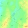
Arthurton topographic map

Click on the map to display elevation.

About this map

Name: Arthurton topographic map, elevation, terrain.

Location: Arthurton, Yorke Peninsula Council, South Australia, 5572, Australia (-34.27634 137.68069 -34.18682 137.87266)

Average elevation: 148 m

Minimum elevation: 73 m

Maximum elevation: 244 m

Other topographic maps

Click on a map to view its topography, its elevation and its terrain.
Gear up for your next adventure:

🧰Survival Kit - Essential gear for emergencies in the wilderness
🛁Quick-Dry Microfiber Towel - Space-saving towel that dries rapidly on the move
⛺Tent Footprint - Protect tent floor and increase durability
🧢Hiking Hat - Sun-protective and breathable hats for long treks
🔦LED Headtorch - Bright and durable light for night activities

As an Amazon Associate, this site earns from qualifying purchases at no extra cost to you.