
Graceville topographic map
Click on the map to display elevation.
Graceville
Jackson County is a rural community primarily composed of business in agriculture, manufacturing, service, and retail trade. In addition, many government facilities are located within the county, including a federal prison and three state correctional institutions. Elevation ranges from 50 to 330 feet (100 m) above sea level. Marianna is 185 feet (56 m) above sea level.
About this map
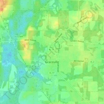
Name: Graceville topographic map, elevation, terrain.
Location: Graceville, Jackson County, Florida, United States (30.94501 -85.53256 30.97580 -85.48876)
Average elevation: 48 m
Minimum elevation: 32 m
Maximum elevation: 69 m
Other topographic maps
Click on a map to view its topography, its elevation and its terrain.