Geolocate

Taiqian topographic map

Click on the map to display elevation.

About this map
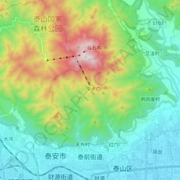
Name: Taiqian topographic map, elevation, terrain.

Location: Taiqian, Taishan District, Tai'an City, Shandong, 271000, China (36.18861 117.06537 36.28657 117.19330)

Average elevation: 513 m

Minimum elevation: 132 m

Maximum elevation: 1,529 m

Other topographic maps

Click on a map to view its topography, its elevation and its terrain.

Gateway

China > Shandong > Taishan District

Average elevation: 201 m

Gear up for your next adventure:

⛺Family Camping Tent - Spacious tent suitable for family camping trips
🧥Waterproof Hiking Jacket - Protect yourself from rain and wind while hiking
🧭Orienteering Kit - Tools for map reading and navigation in the wild
🌬️Windproof Camp Stove - Efficient cooking even on exposed mountain peaks
🎒Fully Waterproof Backpack - Total protection for photography gear and electronics

As an Amazon Associate, this site earns from qualifying purchases at no extra cost to you.