Geolocate

Qiantangcun topographic map

Click on the map to display elevation.

About this map

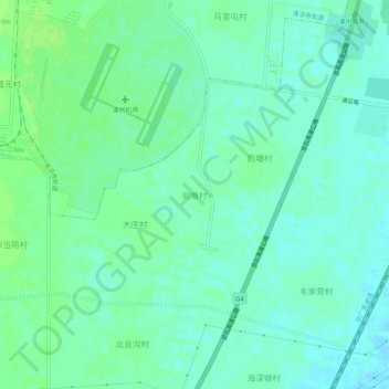
Name: Qiantangcun topographic map, elevation, terrain.

Location: Qiantangcun, Baoding City, Hebei, 072750, China (39.42598 115.98926 39.46598 116.02926)

Average elevation: 34 m

Minimum elevation: 29 m

Maximum elevation: 40 m

Other topographic maps

Click on a map to view its topography, its elevation and its terrain.

Nandayuan

China > Hebei > Baoding City

Average elevation: 19 m

Acient Lotus Pool

China > Hebei > Baoding City

Average elevation: 22 m

Acient Lotus Pool

China > Hebei > Baoding City

Average elevation: 22 m

Laiyuan County

China > Hebei > Baoding City

Average elevation: 1,013 m

Qingyuan District

China > Hebei > Baoding City

Average elevation: 20 m

Fuping County

China > Hebei > Baoding City

Average elevation: 813 m

Gear up for your next adventure:

👖Convertible Hiking Pants - Zip-off legs to adapt to changing weather conditions
🧣Merino Neck Gaiter - Protects against wind, sun, and cold at high altitudes
🩹Compact First Aid Kit - Pre-packed essentials for common trail injuries
🦶Hiking Shoe Insoles - Added support for high arches and long days on feet
🪜Heavy Duty Carabiners - Multi-use clips for securing gear to your backpack

As an Amazon Associate, this site earns from qualifying purchases at no extra cost to you.