Geolocate

Le Mourcy topographic map

Click on the map to display elevation.

About this map
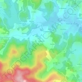
Name: Le Mourcy topographic map, elevation, terrain.

Location: Le Mourcy, Saint-Oradoux-de-Chirouze, Aubusson, Creuse, Nouvelle-Aquitaine, France métropolitaine, 23100, France (45.71205 2.33794 45.75205 2.37794)

Average elevation: 797 m

Minimum elevation: 745 m

Maximum elevation: 927 m

Other topographic maps

Click on a map to view its topography, its elevation and its terrain.
Gear up for your next adventure:

🌬️Windproof Camp Stove - Efficient cooking even on exposed mountain peaks
🔥Camping Stove - Portable stoves to cook outdoors with ease
🥾Trekking Boots - Durable boots for long-distance trekking
🧭GPS Tracker - Track your location in remote areas safely
🧥Fleece Jacket - Warm and lightweight jacket for layering

As an Amazon Associate, this site earns from qualifying purchases at no extra cost to you.