
Roxton topographic map
Interactive map
Click on the map to display elevation.
About this map
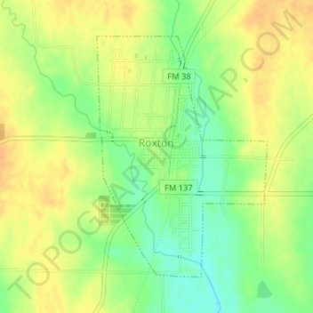
Name: Roxton topographic map, elevation, terrain.
Location: Roxton, Lamar County, Texas, 75477, États-Unis d'Amérique (33.53463 -95.73195 33.55544 -95.71427)
Average elevation: 159 m
Minimum elevation: 140 m
Maximum elevation: 172 m
Other topographic maps
Click on a map to view its topography, its elevation and its terrain.
Sun Valley
États-Unis d'Amérique > Texas > Lamar County
Sun Valley, Lamar County, Texas, États-Unis d'Amérique
Average elevation: 166 m