Geolocate

Sigowet topographic map

Click on the map to display elevation.

About this map

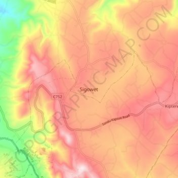
Name: Sigowet topographic map, elevation, terrain.

Location: Sigowet, Sigowet/Soin, Kericho County, Kenya (-0.43240 35.02256 -0.35240 35.10256)

Average elevation: 1,713 m

Minimum elevation: 1,397 m

Maximum elevation: 1,906 m

Gear up for your next adventure:

🧊Portable Cooler - Keep food and drinks cold during outdoor adventures
🕶️Polarized Sunglasses - Reduces glare from snow and water at high elevations
🥾Trekking Poles - Adjustable trekking poles to reduce knee stress and improve stability
🎒Hiking Daypack - Lightweight and durable backpacks for day trips and excursions
🔭Compact Binoculars - Lightweight optics for scouting trails and wildlife

As an Amazon Associate, this site earns from qualifying purchases at no extra cost to you.