Geolocate

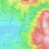
Gardelle topographic map

Click on the map to display elevation.

About this map

Name: Gardelle topographic map, elevation, terrain.

Location: Gardelle, Thiers, Puy-de-Dôme, Auvergne-Rhône-Alpes, France métropolitaine, 63300, France (45.83951 3.50945 45.87951 3.54945)

Average elevation: 387 m

Minimum elevation: 289 m

Maximum elevation: 664 m

Other topographic maps

Click on a map to view its topography, its elevation and its terrain.

63300

France > Auvergne-Rhône-Alpes > Puy-de-Dôme > Thiers > Faux Martel

Average elevation: 421 m

Gear up for your next adventure:

🥾Mountain Hiking Boots - High-traction boots for rocky terrain
⛺Camping Groundsheet - Protect your tent from moisture and dirt
🧤Insulated Winter Gloves - Heavy-duty protection for sub-zero Canadian adventures
🔋Solar Power Bank - Keep your GPS and devices charged during long outdoor trips
🧦Hiking Socks - Moisture-wicking and comfortable socks for long hikes

As an Amazon Associate, this site earns from qualifying purchases at no extra cost to you.