Geolocate

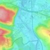
St. Johanner Markt topographic map

Click on the map to display elevation.

About this map

Name: St. Johanner Markt topographic map, elevation, terrain.

Location: St. Johanner Markt, St. Johann, Bezirk Mitte, Saarbrücken, Regionalverband Saarbrücken, Saarland, Germany (49.22909 6.99225 49.23625 7.00393)

Average elevation: 215 m

Minimum elevation: 185 m

Maximum elevation: 305 m

Other topographic maps

Click on a map to view its topography, its elevation and its terrain.

Gear up for your next adventure:

🧤Thermal Hiking Gloves - Grip-enhanced gloves for cold-weather altitude trekking
🛌Insulated Sleeping Pad - Critical thermal barrier between you and the cold ground
🔥Emergency Fire Starter - Reliable ignition source for all weather conditions
⛺Tent Footprint - Protect tent floor and increase durability
🧦Hiking Liner Socks - Thin base layer to prevent friction and blisters

As an Amazon Associate, this site earns from qualifying purchases at no extra cost to you.