
Thank you for supporting this site ❤️
Make a donation
Make a donation
Gear up for your next adventure:
As an Amazon Associate, this site earns from qualifying purchases at no extra cost to you.
Toiriz topographic map
Click on the map to display elevation.
Thank you for supporting this site ❤️
Make a donation
Make a donation
Gear up for your next adventure:
As an Amazon Associate, this site earns from qualifying purchases at no extra cost to you.
About this map
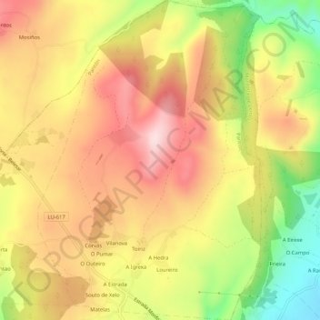
Name: Toiriz topographic map, elevation, terrain.
Location: Toiriz, Pantón, Tierra de Lemos, Lugo, Galicia, España (42.55806 -7.61323 42.59594 -7.57725)
Average elevation: 521 m
Minimum elevation: 343 m
Maximum elevation: 655 m
Thank you for supporting this site ❤️
Make a donation
Make a donation
Gear up for your next adventure:
As an Amazon Associate, this site earns from qualifying purchases at no extra cost to you.