Geolocate

Crossgates topographic map

Click on the map to display elevation.

About this map

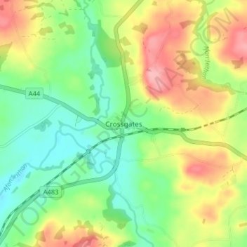
Name: Crossgates topographic map, elevation, terrain.

Location: Crossgates, Powys, Wales, LD1 6RE, United Kingdom (52.25529 -3.35728 52.29529 -3.31728)

Average elevation: 225 m

Minimum elevation: 176 m

Maximum elevation: 293 m

Other topographic maps

Click on a map to view its topography, its elevation and its terrain.

Mochdre

United Kingdom > Wales > Powys

Average elevation: 291 m

Gear up for your next adventure:

🛁Quick-Dry Microfiber Towel - Space-saving towel that dries rapidly on the move
🥘Camping Cookware Set - Compact nesting pots and pans for trail cooking
🥾Waterproof Hiking Shoes - Durable shoes for wet and rugged trails
👟Leg Gaiters - Keep debris, mud, and snow out of your boots
🧦Outdoor Socks - Durable socks designed for hiking and outdoor sports

As an Amazon Associate, this site earns from qualifying purchases at no extra cost to you.