Geolocate

Kipepeo Conservancy topographic map

Click on the map to display elevation.

About this map

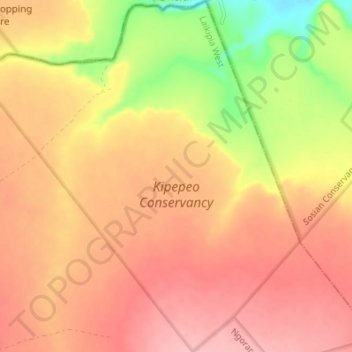
Name: Kipepeo Conservancy topographic map, elevation, terrain.

Location: Kipepeo Conservancy, Laikipia West, Laikipia County, Kenya (0.36700 36.67821 0.43536 36.74127)

Average elevation: 1,758 m

Minimum elevation: 1,680 m

Maximum elevation: 1,803 m

Other topographic maps

Click on a map to view its topography, its elevation and its terrain.

Rumuruti

Kenya > Laikipia County > Laikipia West

Average elevation: 1,853 m

Kinamba

Kenya > Laikipia County > Laikipia West

Average elevation: 2,067 m

Rumuruti

Kenya > Laikipia County > Laikipia West

Average elevation: 1,853 m

Marmanet

Kenya > Laikipia County > Laikipia West

Average elevation: 2,326 m

Ol Jabet

Kenya > Laikipia County > Laikipia West

Average elevation: 2,148 m

Gear up for your next adventure:

🧢Hiking Sun Hat - Wide-brimmed protection for exposed mountain ridges
🥾Trail Running Shoes - Lightweight and durable shoes for trail running
🧦Thermal Socks - Warm socks for winter hiking or camping
🔋Emergency Crank Radio - Weather alerts and power without needing batteries
🛶Kayak Dry Bag - Waterproof storage for kayaking adventures

As an Amazon Associate, this site earns from qualifying purchases at no extra cost to you.