Geolocate

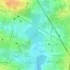
Chikkagubbi topographic map

Click on the map to display elevation.

About this map

Name: Chikkagubbi topographic map, elevation, terrain.

Location: Chikkagubbi, Bangalore East, Bengaluru Urban District, Karnataka, 562149, India (13.06061 77.64622 13.10061 77.68622)

Average elevation: 898 m

Minimum elevation: 877 m

Maximum elevation: 923 m

Other topographic maps

Click on a map to view its topography, its elevation and its terrain.
Varthur Lake

India > Karnataka > Bangalore East > Balagere

Average elevation: 869 m

Kadugodi

India > Karnataka > Bangalore East > Bengaluru

Average elevation: 871 m

Kundalahalli Lake

India > Karnataka > Bangalore East > Bengaluru

Average elevation: 890 m

Doddanekundi Lake

India > Karnataka > Bangalore East > Bengaluru

Average elevation: 885 m

Thanisandra

India > Karnataka > Bangalore East > Bengaluru

Average elevation: 893 m

Doddabanahalli

India > Karnataka > Bangalore East > K Dommasandra

Average elevation: 869 m

Rachenahalli Lake

India > Karnataka > Bangalore East > Bengaluru

Average elevation: 897 m

Kumbena Agrahara

India > Karnataka > Bangalore East > Seegehalli

Average elevation: 863 m

Kelagiankare Lake

India > Karnataka > Bangalore East

Average elevation: 900 m

Gear up for your next adventure:

🥘Camping Cookware Set - Compact nesting pots and pans for trail cooking
🥾Trail Running Boots - Durable shoes designed for trail running
🧥Ultralight Puffy Jacket - Maximum warmth that packs down to the size of an orange
🐕Hiking Dog Pack - Let your canine companion carry their own water and food
🦯Trekking Poles - Reduced impact on joints for steep topographic climbs

As an Amazon Associate, this site earns from qualifying purchases at no extra cost to you.