
Make a donation
Gear up for your next adventure:
As an Amazon Associate, this site earns from qualifying purchases at no extra cost to you.
Canyon Peak topographic map
Click on the map to display elevation.
Make a donation
Gear up for your next adventure:
As an Amazon Associate, this site earns from qualifying purchases at no extra cost to you.
About this map
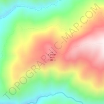
Name: Canyon Peak topographic map, elevation, terrain.
Location: Canyon Peak, Shoshone County, Idaho, United States (47.00764 -115.62298 47.00774 -115.62288)
Average elevation: 1,203 m
Minimum elevation: 834 m
Maximum elevation: 1,624 m
Make a donation
Gear up for your next adventure:
As an Amazon Associate, this site earns from qualifying purchases at no extra cost to you.
Other topographic maps
Click on a map to view its topography, its elevation and its terrain.
Smelterville
United States > Idaho > Shoshone County
Smelterville is located at 47°32′34″N 116°10′45″W / 47.54278°N 116.17917°W / 47.54278; -116.17917 (47.542690, -116.179281), at an elevation of 2,234 feet (681 m) above sea level.
Average elevation: 742 m
Osburn
United States > Idaho > Shoshone County
Osburn is located at 47°30′23″N 116°0′20″W / 47.50639°N 116.00556°W / 47.50639; -116.00556 (47.506464, -116.005535), at an elevation of 2,520 feet (768 m) above sea level.
Average elevation: 934 m
Pinehurst
United States > Idaho > Shoshone County
Pinehurst is located at 47°32′14″N 116°14′14″W / 47.53722°N 116.23722°W / 47.53722; -116.23722 (47.537193, -116.237085). at an elevation of 2,224 feet (678 m) above sea level.
Average elevation: 729 m