Geolocate

Siglioli topographic map

Click on the map to display elevation.

About this map
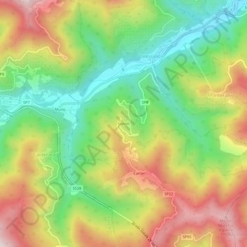
Name: Siglioli topographic map, elevation, terrain.

Location: Siglioli, Vessalico, Provincia di Imperia, Liguria, 18022, Italy (44.01502 7.93422 44.05502 7.97422)

Average elevation: 431 m

Minimum elevation: 149 m

Maximum elevation: 778 m

Gear up for your next adventure:

🧦Hiking Liner Socks - Thin base layer to prevent friction and blisters
📷Outdoor Action Camera - Capture high-elevation views and rugged adventures
🧴Insect Repellent - Protect yourself from bugs during outdoor adventures
🧣Merino Neck Gaiter - Protects against wind, sun, and cold at high altitudes
⛺Camping Groundsheet - Protect your tent from moisture and dirt

As an Amazon Associate, this site earns from qualifying purchases at no extra cost to you.