Geolocate

Sojo topographic map

Click on the map to display elevation.

About this map

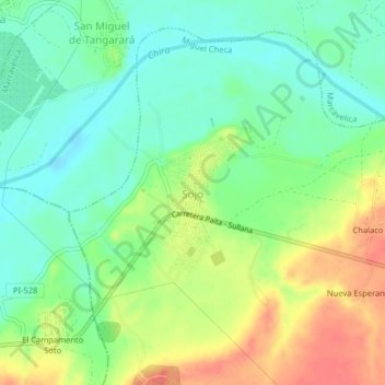
Name: Sojo topographic map, elevation, terrain.

Location: Sojo, Miguel Checa, Sullana, Piura, Perú (-4.92217 -80.83542 -4.88217 -80.79542)

Average elevation: 40 m

Minimum elevation: 18 m

Maximum elevation: 72 m

Gear up for your next adventure:

🥾Hiking Boots - Sturdy boots providing ankle support and traction on rugged trails
🎒Fully Waterproof Backpack - Total protection for photography gear and electronics
🛰️Satellite Messenger - Emergency communication for areas with no cell service
🧥Waterproof Jacket - Lightweight rain jackets for hiking and outdoor activities
🥾Trail Running Shoes - Lightweight and durable shoes for trail running

As an Amazon Associate, this site earns from qualifying purchases at no extra cost to you.