
Thank you for supporting this site ❤️
Make a donation
Make a donation
Gear up for your next adventure:
As an Amazon Associate, this site earns from qualifying purchases at no extra cost to you.
Kiserian topographic map
Click on the map to display elevation.
Thank you for supporting this site ❤️
Make a donation
Make a donation
Gear up for your next adventure:
As an Amazon Associate, this site earns from qualifying purchases at no extra cost to you.
About this map
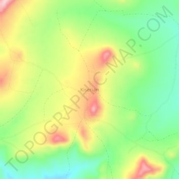
Name: Kiserian topographic map, elevation, terrain.
Location: Kiserian, Monduli, Arusha, Northern Zone, Tanzania (-2.86865 36.50822 -2.82865 36.54822)
Average elevation: 1,588 m
Minimum elevation: 1,493 m
Maximum elevation: 1,710 m
Thank you for supporting this site ❤️
Make a donation
Make a donation
Gear up for your next adventure:
As an Amazon Associate, this site earns from qualifying purchases at no extra cost to you.