Geolocate

Leicester topographic map

Click on the map to display elevation.

About this map
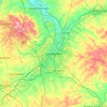
Name: Leicester topographic map, elevation, terrain.

Location: Leicester, City of Leicester, England, LE1 4FB, United Kingdom (52.47620 -1.29320 52.79620 -0.97320)

Average elevation: 109 m

Minimum elevation: 17 m

Maximum elevation: 269 m

Other topographic maps

Click on a map to view its topography, its elevation and its terrain.

River Soar

United Kingdom > England > City of Leicester

Average elevation: 101 m

Gear up for your next adventure:

💧Hydration Pack - Hands-free hydration system for long hikes
🧦Outdoor Socks - Durable socks designed for hiking and outdoor sports
🧢Beanie Hat - Keep your head warm in cold weather
👟Leg Gaiters - Keep debris, mud, and snow out of your boots
🔦LED Flashlight - Powerful and long-lasting flashlight for camping and emergencies

As an Amazon Associate, this site earns from qualifying purchases at no extra cost to you.