Geolocate

Tambobamba topographic map

Click on the map to display elevation.

About this map

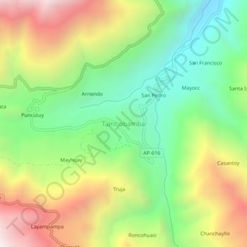
Name: Tambobamba topographic map, elevation, terrain.

Location: Tambobamba, Huanipaca, Abancay, Apurímac, Perú (-13.50230 -72.90908 -13.46230 -72.86908)

Average elevation: 2,775 m

Minimum elevation: 2,189 m

Maximum elevation: 3,587 m

Gear up for your next adventure:

🧥Waterproof Hiking Jacket - Protect yourself from rain and wind while hiking
🧴Waterproofing Spray - Restore the DWR coating on jackets and tents
🥾Waterproof Hiking Boots - Boots keeping your feet dry in wet conditions
🕯️Camping Lantern - Illuminates your entire campsite with high-efficiency LEDs
🪑Ultralight Camping Stool - Compact seating for rest stops during long hikes

As an Amazon Associate, this site earns from qualifying purchases at no extra cost to you.