Geolocate

Chikkodi topographic map

Click on the map to display elevation.

About this map
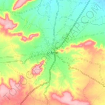
Name: Chikkodi topographic map, elevation, terrain.

Location: Chikkodi, Chikodi taluk, Belagavi, Karnataka, 591200, India (16.38653 74.54613 16.46653 74.62613)

Average elevation: 671 m

Minimum elevation: 585 m

Maximum elevation: 777 m

Gear up for your next adventure:

🧥Ultralight Puffy Jacket - Maximum warmth that packs down to the size of an orange
🧥Waterproof Hiking Jacket - Protect yourself from rain and wind while hiking
🚲Heavy Duty Bike Lock - Secure your bike at the trailhead or during stops
⛺Camping Essentials - All-in-one gear for a comfortable camping trip
🧼Travel Hand Sanitizer - Keep hands clean when water is scarce

As an Amazon Associate, this site earns from qualifying purchases at no extra cost to you.