Geolocate

Hato Verde topographic map

Click on the map to display elevation.

About this map

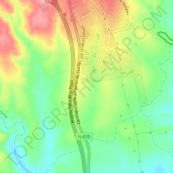
Name: Hato Verde topographic map, elevation, terrain.

Location: Hato Verde, Guillena, Sevilla, Andalucía, 41210, España (37.54930 -6.11043 37.56930 -6.09043)

Average elevation: 109 m

Minimum elevation: 60 m

Maximum elevation: 172 m

Gear up for your next adventure:

🥾All-Terrain Hiking Boots - Versatile boots for varied hiking conditions
🦌Outdoor Trail Camera - Monitor wildlife activity near your favorite spots
🔥Camping Stove - Portable stoves to cook outdoors with ease
🧢Sun Protection Cap - Breathable cap to protect from sun exposure
🥾Trekking Poles - Adjustable trekking poles to reduce knee stress and improve stability

As an Amazon Associate, this site earns from qualifying purchases at no extra cost to you.