
Manduru topographic map
Click on the map to display elevation.
About this map
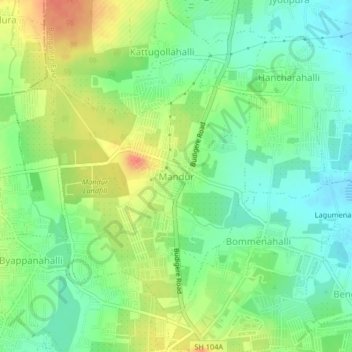
Name: Manduru topographic map, elevation, terrain.
Location: Manduru, Bangalore East, Bengaluru Urban, Karnataka, India (13.06166 77.71702 13.10166 77.75702)
Average elevation: 886 m
Minimum elevation: 865 m
Maximum elevation: 914 m
Other topographic maps
Click on a map to view its topography, its elevation and its terrain.
Atal Bihari Botanical Garden
India > Karnataka > Bangalore East > Doddabanahalli
Average elevation: 877 m
Bengaluru East City Corporation
India > Karnataka > Bangalore East > Bengaluru
Average elevation: 883 m