
Thank you for supporting this site ❤️
Make a donation
Make a donation
Gear up for your next adventure:
As an Amazon Associate, this site earns from qualifying purchases at no extra cost to you.
Ésali-sekîn topographic map
Click on the map to display elevation.
Thank you for supporting this site ❤️
Make a donation
Make a donation
Gear up for your next adventure:
As an Amazon Associate, this site earns from qualifying purchases at no extra cost to you.
About this map
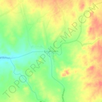
Name: Ésali-sekîn topographic map, elevation, terrain.
Location: Ésali-sekîn, Abalessa, Abalessa District, Tamanrasset, Algeria (22.82811 5.08475 22.86811 5.12475)
Average elevation: 1,045 m
Minimum elevation: 1,013 m
Maximum elevation: 1,073 m
Thank you for supporting this site ❤️
Make a donation
Make a donation
Gear up for your next adventure:
As an Amazon Associate, this site earns from qualifying purchases at no extra cost to you.