Geolocate

Number One topographic map

Click on the map to display elevation.

About this map

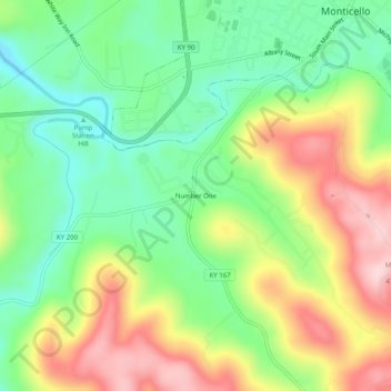
Name: Number One topographic map, elevation, terrain.

Location: Number One, Wayne County, Kentucky, 42633, United States (36.79090 -84.88828 36.83090 -84.84828)

Average elevation: 325 m

Minimum elevation: 216 m

Maximum elevation: 477 m

Other topographic maps

Click on a map to view its topography, its elevation and its terrain.

Monticello

United States > Kentucky > Wayne County

Average elevation: 304 m

Monticello

United States > Kentucky > Wayne County

Average elevation: 304 m

Gear up for your next adventure:

🦯Trekking Poles - Reduced impact on joints for steep topographic climbs
🧥Softshell Jacket - Windproof and breathable jacket for hiking
🥾Waterproof Hiking Boots - Essential footwear for rugged terrain and wet Canadian trails
Camping Essentials - All-in-one gear for a comfortable camping trip
🛶Canoe Life Vest - Safety vest for water sports

As an Amazon Associate, this site earns from qualifying purchases at no extra cost to you.