Geolocate

Shaw topographic map

Click on the map to display elevation.

About this map

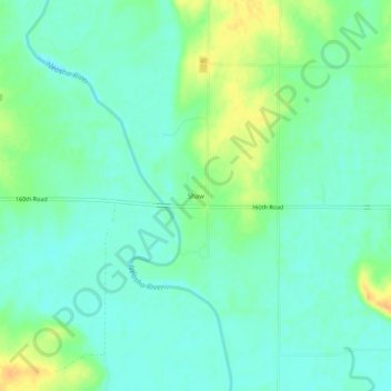
Name: Shaw topographic map, elevation, terrain.

Location: Shaw, Neosho County, Kansas, United States (37.58227 -95.33748 37.62227 -95.29748)

Average elevation: 276 m

Minimum elevation: 265 m

Maximum elevation: 299 m

Other topographic maps

Click on a map to view its topography, its elevation and its terrain.

Chanute

United States > Kansas > Neosho County

Average elevation: 287 m

Chanute

United States > Kansas > Neosho County

Average elevation: 287 m

Gear up for your next adventure:

🥾Trail Hiking Boots - Supportive boots for rough trails
🛶Kayak Accessories - Essential gear for safe and fun kayaking adventures
💧Reusable Water Bottle - Durable water bottles for hydration on trails
🛌Down Sleeping Bag - Superior warmth-to-weight ratio for cold nights
🥾Waterproof Hiking Shoes - Durable shoes for wet and rugged trails

As an Amazon Associate, this site earns from qualifying purchases at no extra cost to you.