Geolocate

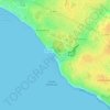
Les Granges topographic map

Click on the map to display elevation.

About this map

Name: Les Granges topographic map, elevation, terrain.

Location: Les Granges, Olonne-sur-Mer, Les Sables-d'Olonne, Vendée, Pays de la Loire, France métropolitaine, 85340, France (46.57120 -1.85575 46.61120 -1.81575)

Average elevation: 6 m

Minimum elevation: -22 m

Maximum elevation: 51 m

Other topographic maps

Click on a map to view its topography, its elevation and its terrain.

85180

France > Pays de la Loire > Vendée > Les Sables-d'Olonne

Average elevation: 28 m

Gear up for your next adventure:

🧴Sunscreen SPF - Broad-spectrum sunscreen for outdoor activities
🥾Lightweight Hiking Boots - Boots for comfort and mobility on long hikes
🧴Bear Spray Holster - Quick-access carry for essential Canadian wilderness safety
🧊Insulated Water Bottle - Keeps drinks cold in summer and prevents freezing in winter
🧦Hiking Liner Socks - Thin base layer to prevent friction and blisters

As an Amazon Associate, this site earns from qualifying purchases at no extra cost to you.