Geolocate

Orogolday topographic map

Click on the map to display elevation.

About this map

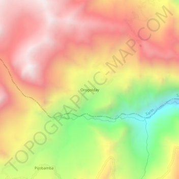
Name: Orogolday topographic map, elevation, terrain.

Location: Orogolday, Sarín, Sánchez Carrión, La Libertad, Perú (-8.02136 -77.81495 -7.98136 -77.77495)

Average elevation: 3,691 m

Minimum elevation: 2,953 m

Maximum elevation: 4,229 m

Gear up for your next adventure:

💡Portable Camping Lamp - Rechargeable lamp for campsite lighting
🎒Backpack Rain Cover - External shield to keep your entire pack dry
🥾Mountain Hiking Boots - High-traction boots for rocky terrain
🧴Insect Repellent - Protect yourself from bugs during outdoor adventures
🥾Trail Running Shoes - Lightweight and durable shoes for trail running

As an Amazon Associate, this site earns from qualifying purchases at no extra cost to you.