Geolocate

Socorro topographic map

Click on the map to display elevation.

About this map

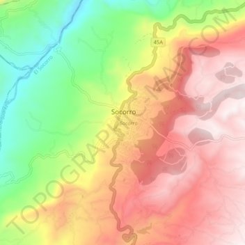
Name: Socorro topographic map, elevation, terrain.

Location: Socorro, El Socorro, Comunera, Santander, 7272071, Colombia (6.42702 -73.30262 6.50702 -73.22262)

Average elevation: 1,190 m

Minimum elevation: 625 m

Maximum elevation: 1,703 m

Gear up for your next adventure:

🛶Kayak Dry Bag - Waterproof storage for kayaking adventures
🥾Lightweight Hiking Shoes - Comfortable shoes for day hikes
🧥Thermal Fleece Jacket - Versatile insulation for changing mountain temperatures
🛶Canoe Life Vest - Safety vest for water sports
🛏️Sleeping Bag - Warm and compact sleeping bags for outdoor camping

As an Amazon Associate, this site earns from qualifying purchases at no extra cost to you.