Geolocate

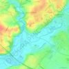
85200 topographic map

Click on the map to display elevation.

About this map

Name: 85200 topographic map, elevation, terrain.

Location: 85200, Le Château, Fontenay-le-Comte, Vendée, Pays de la Loire, France métropolitaine, France (46.35888 -0.91172 46.57706 -0.70931)

Average elevation: 43 m

Minimum elevation: 0 m

Maximum elevation: 131 m

Other topographic maps

Click on a map to view its topography, its elevation and its terrain.

Charzais

France > Pays de la Loire > Vendée > Fontenay-le-Comte

Average elevation: 39 m

Grange

France > Pays de la Loire > Vendée > Fontenay-le-Comte

Average elevation: 30 m

Gear up for your next adventure:

🧭GPS Handheld Device - Reliable GPS navigation for outdoor adventures
⛺Camping Groundsheet - Protect your tent from moisture and dirt
🗺️Topographic Maps - Detailed maps to explore trails, mountains, and wilderness areas
🧦Outdoor Socks - Durable socks designed for hiking and outdoor sports
🥘Camping Cookware Set - Compact nesting pots and pans for trail cooking

As an Amazon Associate, this site earns from qualifying purchases at no extra cost to you.