
Thank you for supporting this site ❤️
Make a donation
Make a donation
Gear up for your next adventure:
As an Amazon Associate, this site earns from qualifying purchases at no extra cost to you.
Ternberg topographic map
Click on the map to display elevation.
Thank you for supporting this site ❤️
Make a donation
Make a donation
Gear up for your next adventure:
As an Amazon Associate, this site earns from qualifying purchases at no extra cost to you.
About this map
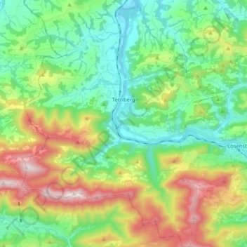
Name: Ternberg topographic map, elevation, terrain.
Location: Ternberg, Bezirk Steyr-Land, Upper Austria, 4452, Austria (47.88272 14.29214 47.98826 14.41674)
Average elevation: 618 m
Minimum elevation: 311 m
Maximum elevation: 1,258 m
Thank you for supporting this site ❤️
Make a donation
Make a donation
Gear up for your next adventure:
As an Amazon Associate, this site earns from qualifying purchases at no extra cost to you.