
Céroux-Mousty topographic map
Interactive map
Click on the map to display elevation.
About this map
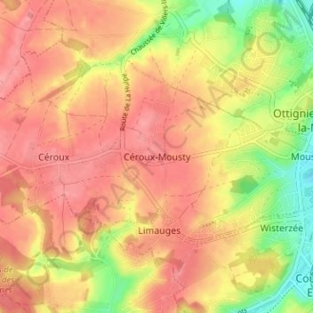
Name: Céroux-Mousty topographic map, elevation, terrain.
Average elevation: 109 m
Minimum elevation: 57 m
Maximum elevation: 138 m
Other topographic maps
Click on a map to view its topography, its elevation and its terrain.
Ottignies
Belgique > Brabant wallon > Nivelles > Ottignies-Louvain-la-Neuve
Ottignies, Ottignies-Louvain-la-Neuve, Nivelles, Brabant wallon, Wallonie, 1340, Belgique
Average elevation: 100 m
Malaise
Belgique > Brabant wallon > Nivelles > Ottignies-Louvain-la-Neuve > Ottignies
Malaise, Blocry, Ottignies, Ottignies-Louvain-la-Neuve, Nivelles, Brabant wallon, Wallonie, 1340, Belgique
Average elevation: 108 m