Geolocate

San Juanito topographic map

Click on the map to display elevation.

About this map

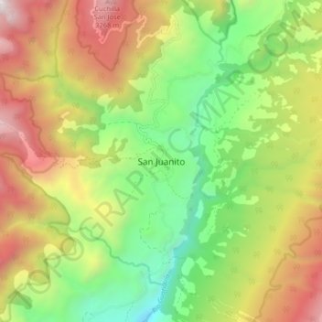
Name: San Juanito topographic map, elevation, terrain.

Location: San Juanito, Piedemonte, Meta, Orinoquia, Colombia (4.41856 -73.71716 4.49856 -73.63716)

Average elevation: 2,273 m

Minimum elevation: 1,329 m

Maximum elevation: 3,509 m

Gear up for your next adventure:

Lightweight Backpacking Tent - Compact tent for efficient hiking trips
🥾Trail Running Shoes - Lightweight and durable shoes for trail running
🦶Anti-Blister Balm - Prevents friction and hotspots during long ascents
🔋Solar Power Bank - Keep your GPS and devices charged during long outdoor trips
🧭Orienteering Kit - Tools for map reading and navigation in the wild

As an Amazon Associate, this site earns from qualifying purchases at no extra cost to you.