Geolocate

San Pablo topographic map

Click on the map to display elevation.

About this map

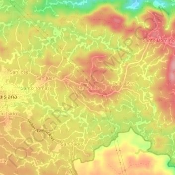
Name: San Pablo topographic map, elevation, terrain.

Location: San Pablo, Luisiana, Laguna, Calabarzon, 4032, Philippines (14.16710 121.50915 14.20710 121.54915)

Average elevation: 382 m

Minimum elevation: 305 m

Maximum elevation: 429 m

Gear up for your next adventure:

🥾Hiking Gaiters - Protect legs and shoes from mud, snow, and debris
🧤Thermal Hiking Gloves - Grip-enhanced gloves for cold-weather altitude trekking
🔋Lithium AA Batteries - Long-lasting power that performs in extreme cold
🧥Waterproof Hiking Jacket - Protect yourself from rain and wind while hiking
🔦UV Flashlight - Detect minerals or specific insects in the dark

As an Amazon Associate, this site earns from qualifying purchases at no extra cost to you.