Geolocate

Aguas Tuertas topographic map

Click on the map to display elevation.

About this map

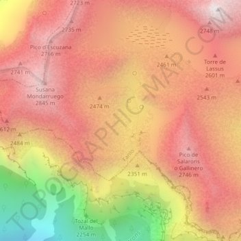
Name: Aguas Tuertas topographic map, elevation, terrain.

Location: Aguas Tuertas, Fanlo, Sobrarbe, Huesca, Aragón, España (42.66265 -0.07918 42.68265 -0.05918)

Average elevation: 2,380 m

Minimum elevation: 1,460 m

Maximum elevation: 2,901 m

Gear up for your next adventure:

🛰️Satellite Messenger - Emergency communication for areas with no cell service
🛌Insulated Sleeping Pad - Critical thermal barrier between you and the cold ground
🥾Waterproof Hiking Shoes - Durable shoes for wet and rugged trails
🥾Hiking Leggings - Comfortable leggings for outdoor activities
🥾Mountain Hiking Shoes - Shoes with superior grip for mountainous terrain

As an Amazon Associate, this site earns from qualifying purchases at no extra cost to you.