Geolocate

Kuta Rayat topographic map

Click on the map to display elevation.

About this map

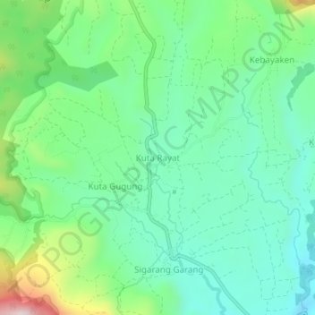
Name: Kuta Rayat topographic map, elevation, terrain.

Location: Kuta Rayat, Karo, North Sumatra, Sumatra, Indonesia (3.18440 98.38899 3.22440 98.42899)

Average elevation: 1,403 m

Minimum elevation: 1,260 m

Maximum elevation: 1,773 m

Other topographic maps

Click on a map to view its topography, its elevation and its terrain.

Berastagi

Indonesia > North Sumatra > Karo

Average elevation: 1,418 m

Gear up for your next adventure:

🥫Freeze-Dried Meals - Lightweight, high-calorie nutrition for multi-day treks
🔦LED Flashlight - Powerful and long-lasting flashlight for camping and emergencies
🧤Thermal Hiking Gloves - Grip-enhanced gloves for cold-weather altitude trekking
🧼Travel Hand Sanitizer - Keep hands clean when water is scarce
Camping Tent - Weather-resistant tents suitable for 2 to 6 people

As an Amazon Associate, this site earns from qualifying purchases at no extra cost to you.