Geolocate

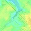
Purus River topographic map

Click on the map to display elevation.

Purus River

William Chandless found its elevation above sea level to be only 107 feet (33 m) 590 miles (950 km) from its mouth. It is one of the most crooked streams in the world, and its length in a straight line is less than half of its length following its curves. It is practically only a drainage ditch for the half-submerged, lake-flooded district it crosses. Its width is very uniform for 1,000 miles (1,600 km) up, and for 800 miles (1,300 km) its depth is never less than 45 feet (14 m).

Wikipedia (CC-BY-SA 3.0)

About this map

Name: Purus River topographic map, elevation, terrain.

Location: Purus River, North Region, Brazil (-10.74853 -71.79535 -3.66480 -61.36902)

Average elevation: 133 m

Minimum elevation: 11 m

Maximum elevation: 1,445 m

Other topographic maps

Click on a map to view its topography, its elevation and its terrain.

Sitio

Brazil > Maranhão > Loreto

Average elevation: 286 m

Caatinga

Brazil > Bahia > Contendas do Sincorá > Caatinga

Average elevation: 349 m

Caminho

Brazil > Santa Catarina > Dona Emma

Average elevation: 460 m

Bueno

Brazil > Minas Gerais > Conselheiro Pena

Average elevation: 560 m

Parque Boa Vista

Brazil > Ceará > Caucaia

Average elevation: 15 m

Caite

Brazil > Amazonas > Tonantins

Average elevation: 46 m

Rio Grande

Brazil > Pará > Curuçá

Average elevation: 15 m

Vila Deus Provera

Brazil > Pará > Moju

Average elevation: 17 m

Gear up for your next adventure:

🏃Hydration Running Vest - Carry water and maps close to your body for speed
🥾Light Hiking Boots - Lightweight and comfortable boots for day hikes
🥾Light Trekking Boots - Supportive boots for multi-day treks
🧊Insulated Water Bottle - Keeps drinks cold in summer and prevents freezing in winter
💡Solar Camping Lamp - Eco-friendly lighting for campsites

As an Amazon Associate, this site earns from qualifying purchases at no extra cost to you.