
Axamer Lizum topographic map
Click on the map to display elevation.
Axamer Lizum
The ski area is well known for a large variety of options to ski or snowboard off the marked piste. The highest location of the ski area is the mountain Hoadl with an altitude of 2,340 m, which is relatively high for a ski area in this region of the Alps. Thus, the Axamer Lizum has a reputation to be among the last (non glacier-based) ski resorts in the north of Tyrol which have sufficient snow for winter sport at the end of winter.
About this map
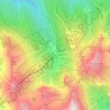
Name: Axamer Lizum topographic map, elevation, terrain.
Average elevation: 1,858 m
Minimum elevation: 1,213 m
Maximum elevation: 2,513 m