Geolocate

Sarolangun topographic map

Click on the map to display elevation.

About this map

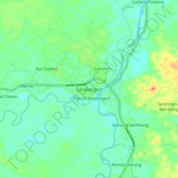
Name: Sarolangun topographic map, elevation, terrain.

Location: Sarolangun, Jambi, Sumatra, 37481, Indonesia (-2.34513 102.67753 -2.26513 102.75753)

Average elevation: 41 m

Minimum elevation: 27 m

Maximum elevation: 74 m

Other topographic maps

Click on a map to view its topography, its elevation and its terrain.

Batang Asai

Indonesia > Jambi > Sarolangun

Average elevation: 365 m

Gear up for your next adventure:

🪑Ultralight Camping Stool - Compact seating for rest stops during long hikes
Camping Groundsheet - Protect your tent from moisture and dirt
🥾Trail Hiking Shoes - Durable shoes designed for rugged trails
🥾Waterproof Trail Shoes - Shoes designed to handle wet terrain
Lightweight Backpacking Tent - Compact tent for efficient hiking trips

As an Amazon Associate, this site earns from qualifying purchases at no extra cost to you.