Geolocate

Bakung topographic map

Click on the map to display elevation.

About this map

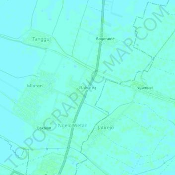
Name: Bakung topographic map, elevation, terrain.

Location: Bakung, Mijen, Demak, Central Java, Java, Indonesia (-6.85489 110.70366 -6.81489 110.74366)

Average elevation: 5 m

Minimum elevation: 3 m

Maximum elevation: 7 m

Other topographic maps

Click on a map to view its topography, its elevation and its terrain.

Mijen

Indonesia > Central Java > Demak

Average elevation: 5 m

Bonang

Indonesia > Central Java > Demak

Average elevation: 3 m

Karanganyar

Indonesia > Central Java > Demak

Average elevation: 7 m

Kali Tulung

Indonesia > Central Java > Demak > Gebangarum

Average elevation: 3 m

Kali Tuntang

Indonesia > Central Java > Demak > Bonangrejo

Average elevation: 4 m

Gear up for your next adventure:

🥾Waterproof Hiking Boots - Boots keeping your feet dry in wet conditions
🧥Packable Rain Jacket - Breathable waterproof layer for unpredictable weather
Camping Groundsheet - Protect your tent from moisture and dirt
🧼Travel Hand Sanitizer - Keep hands clean when water is scarce
🧥Insulated Jacket - Keep warm in cold outdoor conditions

As an Amazon Associate, this site earns from qualifying purchases at no extra cost to you.