Geolocate

Mukai Hilir topographic map

Click on the map to display elevation.

About this map

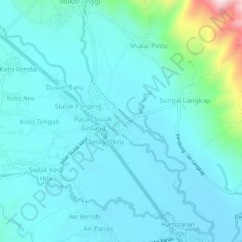
Name: Mukai Hilir topographic map, elevation, terrain.

Location: Mukai Hilir, Kerinci, Jambi, Sumatra, Indonesia (-1.98778 101.33929 -1.94778 101.37929)

Average elevation: 868 m

Minimum elevation: 799 m

Maximum elevation: 1,303 m

Other topographic maps

Click on a map to view its topography, its elevation and its terrain.

Sungai Kuning

Indonesia > Jambi > Kerinci

Average elevation: 1,247 m

Sungai Siulak Deras Kanan

Indonesia > Jambi > Kerinci > Sako Duo

Average elevation: 1,762 m

Gear up for your next adventure:

🛶Waterproof Dry Bags - Keep electronics and clothes dry during river crossings
🥾Approach Boots - Comfortable boots for hiking and climbing approaches
🔥Camping Stove - Portable stoves to cook outdoors with ease
Camping Groundsheet - Protect your tent from moisture and dirt
🎒Hiking Backpack - Lightweight and ergonomic backpacks for day hikes or multi-day treks

As an Amazon Associate, this site earns from qualifying purchases at no extra cost to you.