Geolocate

Nongsa topographic map

Click on the map to display elevation.

About this map

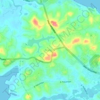
Name: Nongsa topographic map, elevation, terrain.

Location: Nongsa, Batam, Riau Islands, Sumatra, 29467, Indonesia (1.14563 104.08672 1.18563 104.12672)

Average elevation: 20 m

Minimum elevation: -2 m

Maximum elevation: 78 m

Other topographic maps

Click on a map to view its topography, its elevation and its terrain.

Sungai Kecil

Indonesia > Riau Islands > Batam > Batu Aji

Average elevation: 25 m

Gear up for your next adventure:

👟Leg Gaiters - Keep debris, mud, and snow out of your boots
🔋Lithium AA Batteries - Long-lasting power that performs in extreme cold
🥾Light Hiking Boots - Lightweight and comfortable boots for day hikes
🦌Outdoor Trail Camera - Monitor wildlife activity near your favorite spots
🥾Trekking Boots - Durable boots for long-distance trekking

As an Amazon Associate, this site earns from qualifying purchases at no extra cost to you.