
Thank you for supporting this site ❤️
Make a donation
Make a donation
Gear up for your next adventure:
As an Amazon Associate, this site earns from qualifying purchases at no extra cost to you.
Guguak topographic map
Click on the map to display elevation.
Thank you for supporting this site ❤️
Make a donation
Make a donation
Gear up for your next adventure:
As an Amazon Associate, this site earns from qualifying purchases at no extra cost to you.
About this map
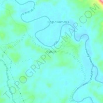
Name: Guguak topographic map, elevation, terrain.
Location: Guguak, Sijunjung, West Sumatra, Sumatra, Indonesia (-0.59807 100.83657 -0.55807 100.87657)
Average elevation: 175 m
Minimum elevation: 149 m
Maximum elevation: 324 m
Thank you for supporting this site ❤️
Make a donation
Make a donation
Gear up for your next adventure:
As an Amazon Associate, this site earns from qualifying purchases at no extra cost to you.