Geolocate

Punoli topographic map

Click on the map to display elevation.

About this map

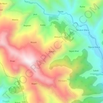
Name: Punoli topographic map, elevation, terrain.

Location: Punoli, Hirdam, Ranikhet, Almora, Uttarakhand, India (29.52895 79.43448 29.56895 79.47448)

Average elevation: 1,378 m

Minimum elevation: 955 m

Maximum elevation: 1,889 m

Gear up for your next adventure:

🦶Anti-Blister Balm - Prevents friction and hotspots during long ascents
Camping Coffee Maker - Brew fresh coffee anywhere on the topographic map
🧢Sun Protection Cap - Breathable cap to protect from sun exposure
🧣Merino Neck Gaiter - Protects against wind, sun, and cold at high altitudes
🔥Camping Stove - Portable stoves to cook outdoors with ease

As an Amazon Associate, this site earns from qualifying purchases at no extra cost to you.