Geolocate

Ciwaru topographic map

Click on the map to display elevation.

About this map

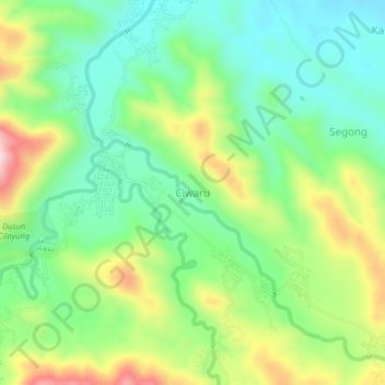
Name: Ciwaru topographic map, elevation, terrain.

Location: Ciwaru, Kuningan, West Java, Java, 45583, Indonesia (-7.09858 108.61660 -7.05858 108.65660)

Average elevation: 216 m

Minimum elevation: 104 m

Maximum elevation: 419 m

Other topographic maps

Click on a map to view its topography, its elevation and its terrain.

Gear up for your next adventure:

🕶️Polarized Sunglasses - Reduces glare from snow and water at high elevations
💡LED Headlamp - Hands-free illumination for night hiking and camping
🧦Thermal Socks - Warm socks for winter hiking or camping
🧴Sunscreen SPF - Broad-spectrum sunscreen for outdoor activities
🔋Emergency Crank Radio - Weather alerts and power without needing batteries

As an Amazon Associate, this site earns from qualifying purchases at no extra cost to you.