
Fulda topographic map
Interactive map
Click on the map to display elevation.
About this map
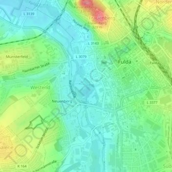
Name: Fulda topographic map, elevation, terrain.
Location: Fulda, Landkreis Fulda, Hesse, 36037, Germany (50.54816 9.66525 50.55253 9.66841)
Average elevation: 270 m
Minimum elevation: 242 m
Maximum elevation: 328 m