Geolocate

Kariene topographic map

Click on the map to display elevation.

About this map

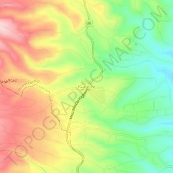
Name: Kariene topographic map, elevation, terrain.

Location: Kariene, Imenti Central, Meru County, Eastern, Kenya (-0.05952 37.64048 -0.01952 37.68048)

Average elevation: 1,516 m

Minimum elevation: 1,391 m

Maximum elevation: 1,652 m

Gear up for your next adventure:

🔦LED Flashlight - Powerful and long-lasting flashlight for camping and emergencies
🔥Camping Stove - Portable stoves to cook outdoors with ease
🏃Hydration Running Vest - Carry water and maps close to your body for speed
🥤Collapsible Travel Cup - Saves space and weight in your mess kit
🥾Lightweight Hiking Shoes - Comfortable shoes for day hikes

As an Amazon Associate, this site earns from qualifying purchases at no extra cost to you.