
Stadl an der Mur topographic map
Interactive map
Click on the map to display elevation.
About this map
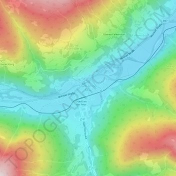
Name: Stadl an der Mur topographic map, elevation, terrain.
Location: Stadl an der Mur, Murau, Stiermarken, 8862, Oostenrijk (47.06705 13.96380 47.10705 14.00380)
Average elevation: 1,138 m
Minimum elevation: 864 m
Maximum elevation: 1,638 m